-40%
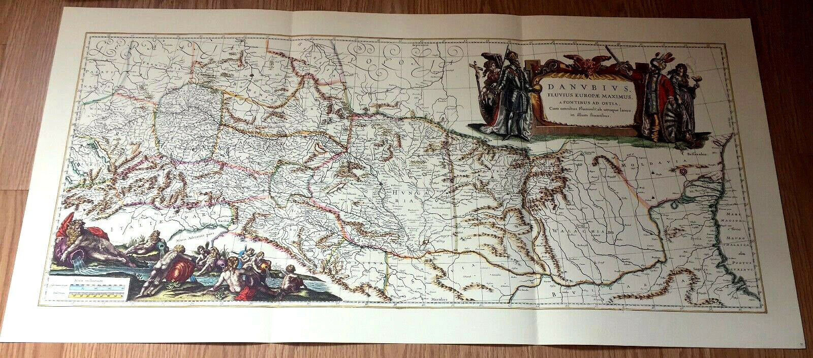
1657 Danube River MAP Reproduction Europe Germany Danubius Fluviorum Jansson
$ 18.48
- Description
- Size Guide
Description
1657 Danube River Map Germany Danubius FluviorumJan Jansson, Cartographer
Reproduction Europe
(I bought several of these good quality reproduction maps of Germany several decades ago. I have another map about the Rhine - would ship both together, one price.)
Donaulauf Copperplate Engraving Rhine river - - Blaeu, Willem 1663
Colored good-quality reproduction map, 17" by 36".
This beautiful large-scale map shows the course of the Rhine from its source to its mouth. -
Top right:
The title cartouche
.
The inscription reads:
"Danubius, fluvius Europae maximus, a fontibus ad ostia, cum omnibus fluminibus, from utroque latere to illium defluentibus"
. Translated:
"Danube, Europe's largest river, from the sources to the mouth, with all the rivers flowing into them from both sides."
The pictures show on the left the emperor Ferdinand III. and on the right the Turkish sultan. The Danube connects the Holy Roman Empire with the Turkish Empire, the raised swords separate both.
Bottom left:
A
llegorical figures that symbolize the source rivers of the Danube and the tributaries.
Donaulauf Copperplate Engraving by Johannes Janssonius 1657. One of the most beautiful Danube Maps of the 17th Century depicting the river basin of the Danube with its tributaries.
Johannes Janssonius (1588, Arnhem – 1664, Amsterdam) (born Jan Janszoon, in English also Jan Jansson) was a Dutch cartographer and publisher who lived and worked in Amsterdam in the 17th century.


